Field Trips
Pre-Symposium Field Trip
Danube Delta Trip
Monday, 29 September, 2025
Convener: Silviu Rădan, senior researcher National Institute of Marine Geology and Geoecology – GeoEcoMar Bucharest, specialist in sedi- mentology, marine and environmental ecology, with decades of experience in the study of the Danube Delta.
Departure from Tulcea in the morning and return in the evening.
Fee: 85 Euro
The fee includes the cost of boats, cart transport to the Holocene sand dunes, paid entrances, English-speaking guided tours, lunch, and refresh- ments. We recommend delegates on this field trip arrange accommodation in Tulcea for the night before the field trip – accommodation is not included in the field trip fee.
Participants: Maximum number 60.
Programme:
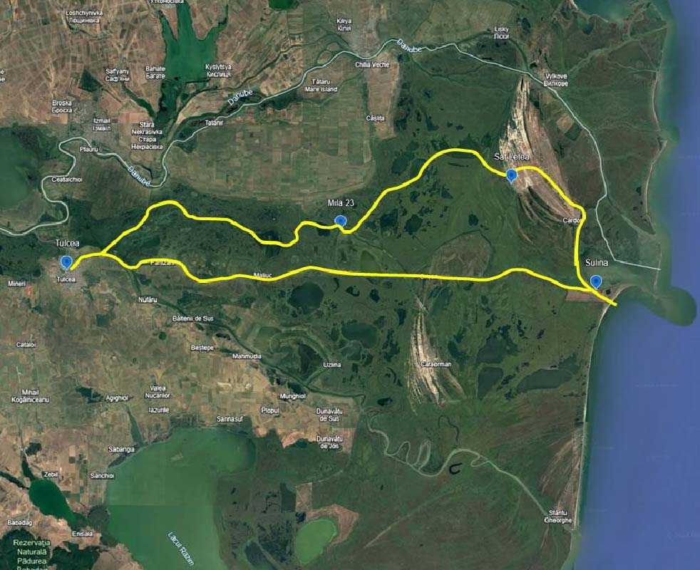
Our excursion is made aboard a tourist ship that will cross the delta from west to east, starting from Tulcea (city located near the apex of the delta), to Sulina, in the area where the Danube meets the Black Sea. Participants will board the ship from the „Select Tours” pontoon in the Tulcea Port, on the “Ivan Patzaichin” promenade near the Delta Hotel.
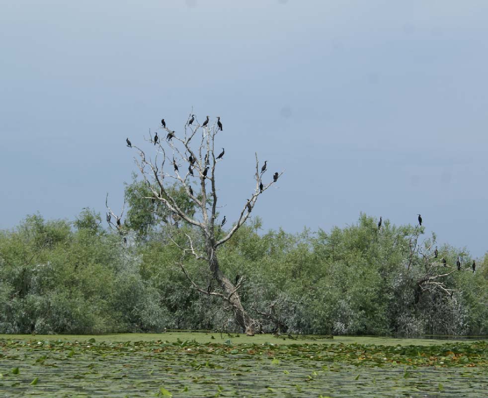
After traveling about 5.6 km downstream, the ship enters the Mila 36 canal (an artificial channel that connects with the Chilia Arm). After a few km, in the Sireasa area, we enter Gârla Șontea, a natural and fairly long channel, along which we can observe the rich vegetation and fauna specific to the delta (especially birds). We change direction slightly to the south and cross the Lake Fortuna, one of the most beautiful and exotic lakes of the delta, then a new change of direction, north, towards the lakes Văcaru and Lighianca. Once crossing these lakes, we reach Mila 23 – a charming fishing village located on the right bank of one of the old meanders of the Sulina Branch. Mila 23 is the birthplace of our famous kayak champion Ivan Patzaichin.
In May 2024, the Museum Ivan Patzaichin – Community Innovation Center was opened here. After a short stop at Mila 23, we head northward, through the Eracle Canal and then along Gârla Lopatna, a natural, meandering and particularly picturesque channel, from which we enter Lake Matița and then northeastward into Lake Merhei. Given that in the vicinity, to the north, the strictly protected area of Roșca – Buhaiova is located, which shelters one of the largest pelican reserves, it is very likely that we will encounter large groups of pelicans in the Lopatna-Matița-Merhei area as well. Once we leave Lake Merhei to the east, the crossing of the upper delta plain (fluvial delta) is completed.
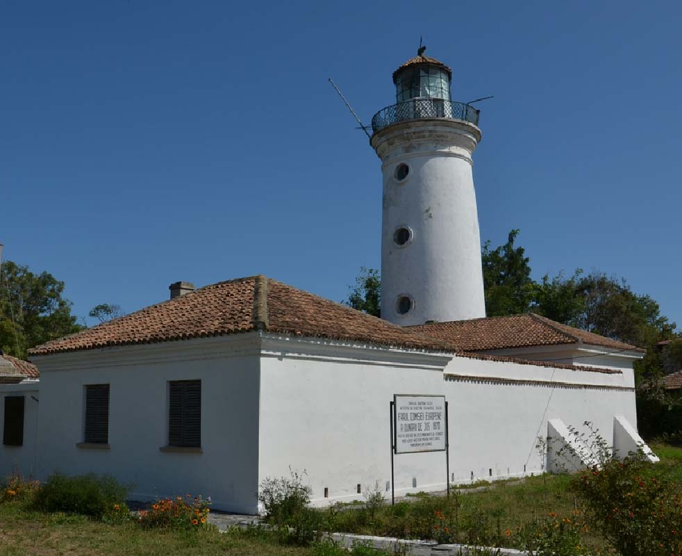
The route continues along the artificial Sidor canal, which crosses the dunes formed on the sandy beach ridges of the Letea marine levee, part of the initial spit, to the village of Letea. Here we will take a trip to the famous Letea forest and sand dunes, a strictly protected area, which includes numerous special floristic and faunal elements (Balkan, Mediterranean, subtropical, steppe), with a special landscape value. Letea Forest is one of the oldest natural reserves in Romania (1938). In the surroundings, there are chances to meet the famous wild horses of Letea. The visit to the forest is done together with the locals, by car or, traditionally, by horse-drawn cart. After this “safari” we’ll have a hearty traditional meal. From Letea we continue towards Sulina on the canals, with a detour to Musura Bay (on the border with Ukraine), where we can see the cargo ship TURGUT S, shipwrecked in 2009, then, weather permitting, we continue into the Black Sea. From the sea we enter the Danube on the Sulina Branch, we pass by the new lighthouse and arrive at Sulina town, the easternmost city of Romania. For an hour we can visit the city, or relax on a terrace with a refreshing drink. In Sulina, there are several historical sites, such as the Old Lighthouse, built in 1802 by the Ottoman authorities and turned into a museum in 2003, as well as the former palace of the European Danube Commission (CED), built in 1866. The Commission operated between 1856 and 1938 and, among other achievements, initiated and coordinated the works to improve and sys- tematize navigation on the Sulina Branch. Thus, between 1862 and 1902, 10 cuts were made on the Sulina Branch, which allowed the route between Tulcea and the Black Sea to be shortened by 249 km and a minimum depth of 5.48 m to be ensured. The works were coordinated by Sir Charles Hartley, who was the chief engineer of the CED between 1856 and 1871. After this year and until his death in 1905, he was a consultant on river and maritime navigation issues. In 2016, a bust of him was installed in front of the former headquarters of the CED.
Our ship returns to Tulcea on the Sulina arm, passing by the villages of Crișan, Gorgova, Maliuc, Vulturu and Partizani.


Mid-symposium Field Trip
Wednesday, 1 October, 2025
Conveners: Iuliana Lazăr, professor of Palaeontology and Palaeozoology, Faculty of Geology and Geophysics, University of Bucharest; Antoneta Seghedi, senior researcher National Institute of Marine Geology and Geoecology – GeoEcoMar, Bucharest, Cimmerian Dobrogea Geopark initiative group; Aurel Daniel Stănică, senior researcher, preventive archaeology/medieval archaeology, „Gavrilă Simion” Eco-Museum Research Institute, Tulcea.
Included in the Registration fee
The mid-symposium trip includes a visit to the Agighiol geological reserve with Triassic ammonoids. This is followed by a visit to the ruins of Aegyssus fortress and the Museum of History and Archaeology, both located on the Monument Hill in Tulcea, on Induan fanglomerates. The museum hosts treasures and artefacts found in the Tulcea County.
At the top of the hill, the Monument of Independence, built after the Russo-Turkish War (1877-1878), is one of the major attractions in Tulcea. This place offers panoramic views of the city, of the western part of the Delta and the north-eastern part of North Dobrogea.
Post-Symposium Field Trip
The Geological and Cultural Heritage of the Cimmerian Dobrogea Geopark
Friday 3rd – Sunday 5th October, 2025
Conveners: Antoneta Seghedi, senior researcher National Institute of Marine Geology and Geoecology – GeoEcoMar, Bucharest, Cimmerian Dobrogea Geopark initiative group; Iuliana Lazăr, professor of Palaeontology and Palaeozoology, Faculty of Geology and Geophysics, University of Bucharest; Silviu Rădan, senior researcher GeoEcoMar Bucharest, specialized in sedimentology, marine and environmental ecology; Aurel Daniel Stănică, senior researcher, preventive archaeology/medieval archaeology, „Gavrilă Simion” Eco-Museum Research Institute, Tulcea; Mihaela Iacob, archaeologist, protection of cultural heritage, lecturer „Lower Danube” University, Galați, Cimmerian Dobrogea Geopark initiative group.
The territory of the Cimmerian Dobrogea Geopark includes two main geotectonic units, the Cimmerian Orogen of North Dobrogea (in the North), separated by Peceneaga-Camena Fault from the Moesian Plat- form (to the South). Late Cretaceous shallow marine successions (“Babadag Basin”) unconformably overlay both these major units. North of the Cimmerian Orogen lies the concealed Scythian Platform, which is the basement of the Danube Delta. The Cimmerian belt shows a complex geology and structure, with folds and thrust-folds exposing Variscan roots in cores of Triassic anticlines. The Măcin Unit, in the west (consisting of amphibolite to greenschist facies metamorphic rocks, very-low grade Silurian to Permo-Carboniferous deposits and granitoid intrusions) is thrusted over the eastern units with Triassic deposits along the Luncaviţa-Consul Fault. Deep marine Silurian – Devonian formations are discontinuously exposed in the core of the E-W trending Tulcea-Mahmudia anticline along the Danube. The Triassic-Jurassic successions crop out mainly east and north-east of the Luncaviţa-Consul Fault.
In the Geopark area, the Ediacaran basement of the Moesian Platform consists largely of turbidites, with well-preserved sedimentary and some- times biogenic structures.
In the first day we will visit geosites in the Măcin Unit, the second day is dedicated to the Triassic-Jurassic formations, and the third day we will travel to the Ediacaran basement. As archaeological sites and historical monuments are found everywhere, some of them are included in the field trip route.
Departure from Tulcea each morning and return in the evening.
Fee: 270 Euro
The fees include the price for coach travel, paid entrances, English-speaking guided tours, lunch, dinner, and refreshments. We rec- ommend delegates on this field trip arrange accommodation in Tulcea for the nights before, during and after the field trip – accommodation is not included in the field trip fee.
Participants: Maximum number 40.
The field trip ends Sunday, 5th of Oc- tober, 2025, at approx. 18:30. Transfer to Bucharest during the night or in the morning of 6th October.
Programme:
Cimmerian Dobrogea Geopark, an introduction to the geological and cultural heritage of the North Dobrogea Orogen and the Ediacaran basement of the Moesian Platform in Central Dobrogea. Localities include:
Hora Tepe (Monument Hill), Tulcea, Lowermost Triassic (Induan, earlier Werfenian) fanglomerates overlying Devonian siliceous shales along a faulted contact. The Devonian deposits show a penetrative slaty cleavage and are intruded by a dyke of trachytes (ascribed to the Late Permian).
Noviodunum, a Roman-byzantine fortress of the Danube limes (fortified border) superimposed by an Ottoman fortification (tabia).
Revărsarea quarry, pillow basalts with rare interbeds of Lower-Middle Triassic limestones.
Consul Hill section, showing the structure of the Consul unit, with three successive thrust folds involving Olenekian (Spathian) limestone turbid- ites and ignimbritic rhyolites, overthrusting the Alba sandstones (Late Carnian-Norian terrigenous turbidites). Roman fortifications are also visible along the northeastern side of the hill.
Nalbant village, outcrops along a small creek, the type locality of Nalbant Formation (Lower Jurassic turbidites).
Cataloi, the type locality of Cataloi marls with Halobia, Upper Anisian (lower Illyrian) – Rhaetian.
Poşta sandstones, South of Posta village, Lower Jurassic sandstones rich in the trace fossil Zoophycos. Their Hettangian-Lower Pliensbachian age is established based on ammonite zones Jamesoni and Ibex.
Crapcea and Amzalar Hills, volcano-sedimentary and alluvial plain successions in the continental Carapelit formation (Lower Carboniferous-Early Permian).
Mircea Vodă, remnants of a palaeoweathering crust on top of meta- morphic rocks below Cenomanian detrital limestones.
Priopcea section, tectonic contact of Megina amphibolites and Priopcea quartzites with the Silurian deposits.
Troesmis, an important archaeological site situated on the steep right bank of the Danube, built in a strategic key position on the Roman Danube limes. The Roman-Byzantine settlement includes visible ruins of two fortifications (the eastern fortification, dating from the Late Roman period, and the western fortification, dated to the middle Byzantine period).
Cape Igliţa, a geosite showing upright Variscan folds in a multilayered succession of Lower Devonian calcarenites and shales.
Cape Orliga, largely metaterrigenous succession of Orliga Group show- ing a Late Carboniferous-Early Permian amphibolite facies metamorphism.
The exposures show complex deformation, with recumbent isoclinal folds in garnet-kyanite micaschists and quartzites, refolded by steeply dipping folds of the metamorphic foliation.
Bal Bair, a hill west of Caugagia, is the type locality of Caugagia member (Lower Coniacian) of the Dolojman Formation, rich in the bivalve Inoceramus.
Slava Rusă village, with (L)Ibida Roman Bizantine city, built from Upper Cretaceous calcarenites.
Casimcea nature reserve, Aspidella and trace fossils in Ediacaran tur- bidites.
Tariverde valley, spectacular ripple marks on large slabs of Ediacaran turbidites; also wrinkle type structures.
Piatra village, beautifully preserved sedimentary structures on bedding surfaces, Beltanelliformis and enigmatic traces in Ediacaran turbidites.
Enisala medieval fortress (built by the Genovese as Heracleea), view over the North Dobrogea orogen.


